

Geophysical Surveys
Mirror underground Assets apply only non-destructive modern state of the art geophysical technologies to locate subsurface anomalies and variation which are man-made or caused by nature. We provide geophysical survey solutions using the following; Ground Penetrating Radar (GPR), Electrical Resistivity Tomography (ERT), and Electromagnetic conductivity meters (EM) in various applications, such as buried utilities, concrete scanning, voids, sink-holes, clandestine graves, fuel pipelines, etc.
GPR & ERT Surveys (Voids, Sinkholes & Subsidence)
Underground Voids, sinkholes, and subsidence are problematic and can lead to a huge cost if not identified at their early stages. Their existence may be attributed to numerous reasons such as a leaky pipe underground which may gradually erode the subsoil supporting these pipes, previous salt mined environment and abandoned landfills or areas where the local geology is associated with karst environments.

Sinkhole initiated by a leaky pipe

ERT Survey — high resistivity region indicative of sinkhole

Residential Sinkhole detected by GPR (geoviewinc.com)
Pavement Condition Surveys
Ground-penetrating radar (GPR) is a non-destructive tool that can be used to obtain information about the construction of pavements and their internal features. This information can be used to enhance pavement condition information obtained from visual condition, deflection surveys, coring, and trial pits.
Mirror Underground Assets can provide a GPR survey for high-speed road assessment with a continuous and complete assessment of road conditions to include: Pavement thickness measurements; surface, base, and sub-base road course assessment; construction changes; detection of cavities; voids and delamination; location of cracks; identification of areas of high moisture, particularly beneath concrete slabs
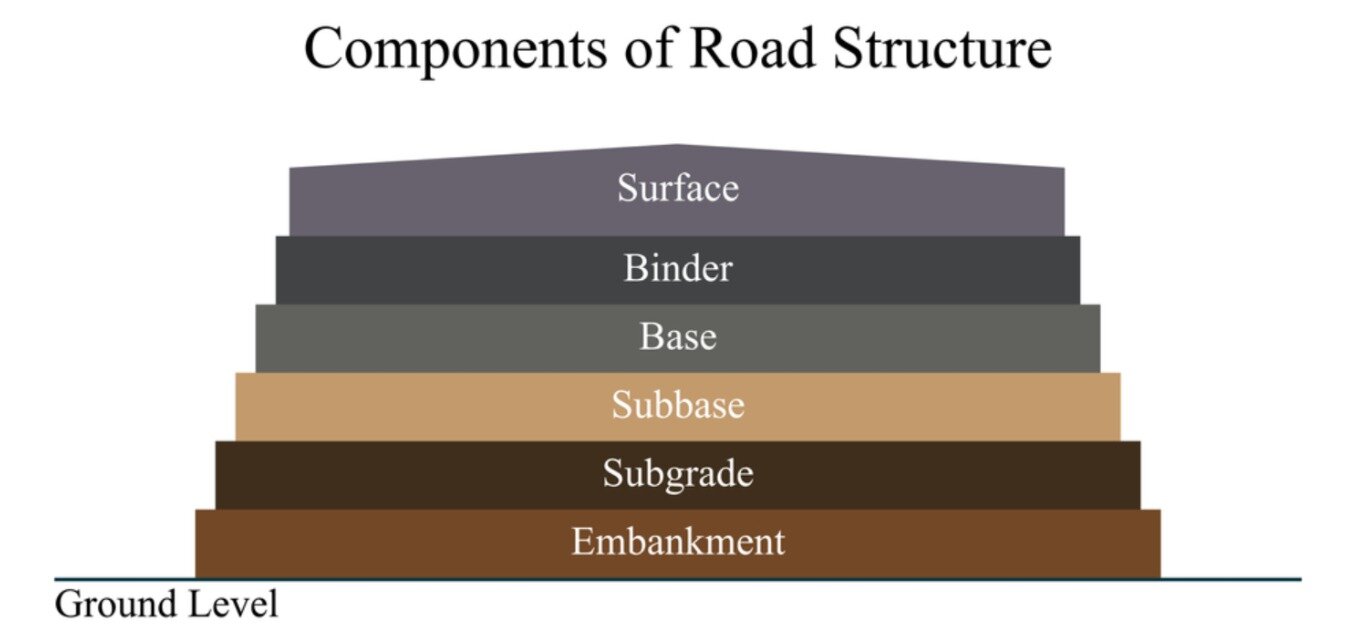
Components of Road Structure

GPR Survey London - Road Condition Survey - hatched boundary suggestive of area with possible structural deterioration