

GPR Scan & GPR Data Interpretation (Buried Utilities, Voids & Sinkholes) supporting Westmidlands, Warwickshire, Herefordshire, Shropshire, Staffordshire, Worcestershire, and London Surroundings.
Our qualified and expert geophysicists can help reduce the stress you might have in interpreting and analyzing your acquired GPR data. Whilst interpreting for underground utilities in the GPR data, with a trained eye, we will ensure that no potential voids or sinkholes would be missed. We highlight all of these features with a color code in AutoCAD or PDF format and produce a detailed report as these anomalies might pose a greater risk to your site.

Planner view free software (viy3) - GPR post-processing for buried utilities (Transient Technologies)

Planner view free software (viy3) - Teblin stacking to improve GPR signal to noise ratio (Transient Technologies)
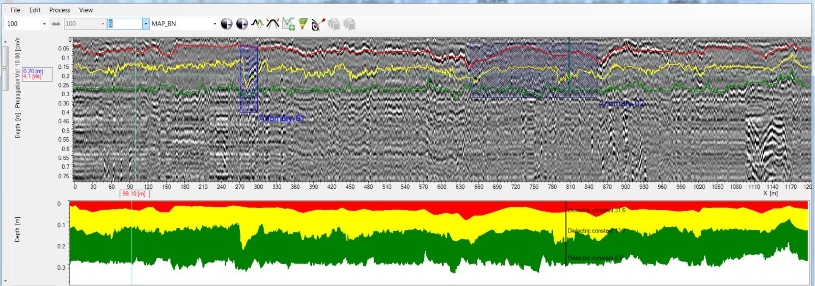
GPR survey London - road condition survey analysis - blue hatched region suggestive of road deterioration (GREH HD3)